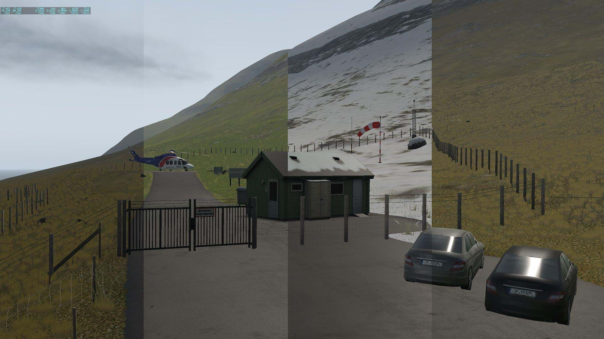
This gem contains 1 main airport and 8 Helipads, custom regional autogen, high quality terrain mesh and rarest of all: seasonal textures.
Oh don’t forget very challenging weather conditions and this is shaping up to be a very interesting product for sure.
Maps2XPlane, perhaps best known for their Arctic and Antarctic Sceneries, as well as custom terrain meshs for many other projects have brought us a scenery with many many hours of content, and that certainly justifies the price. Here’s a quick run down on the key features from their product page:
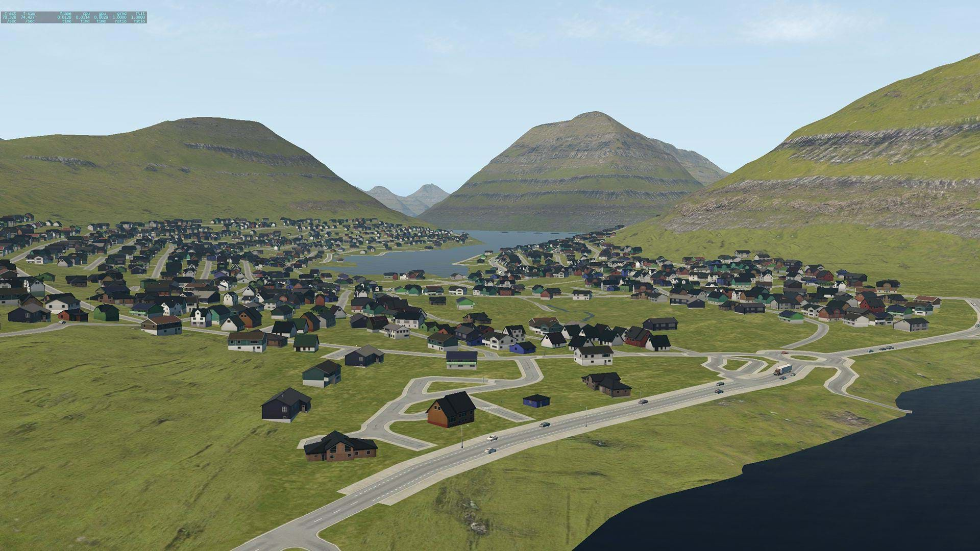
- Realistic recreation of the complete Faroe Islands with an area of about 1400 km2
- High resolution terrain mesh with various texture sets for a seasonal representation
- Customized local terrain details, e.g. realistically sloped runway at the Vágar Airport
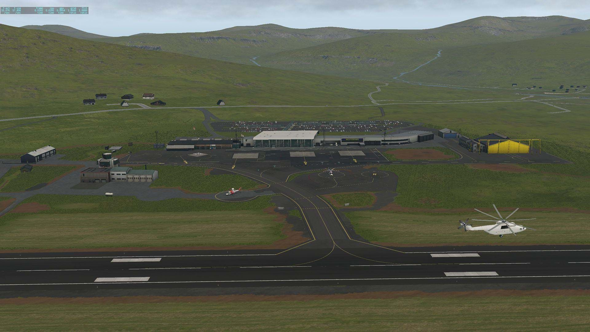
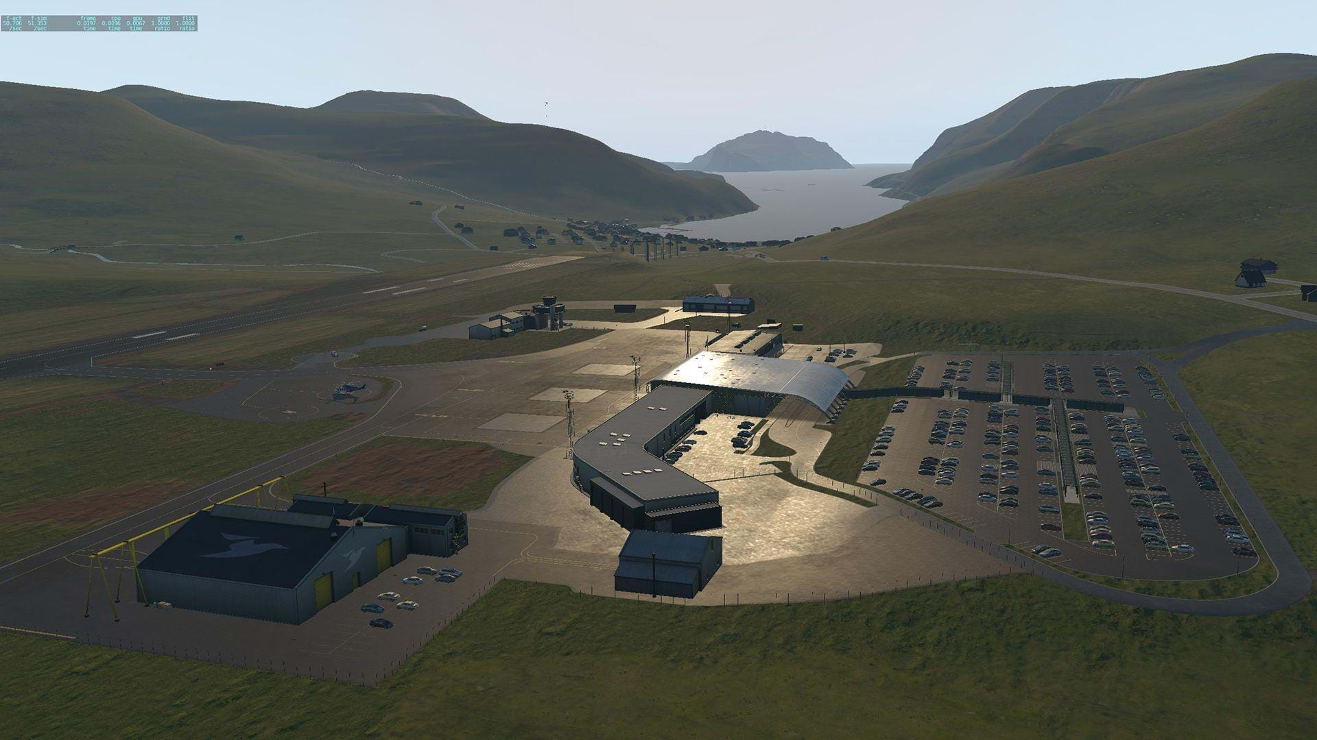
- Detailed rendition of the Vágar Airport and eight helipads spread over the islands
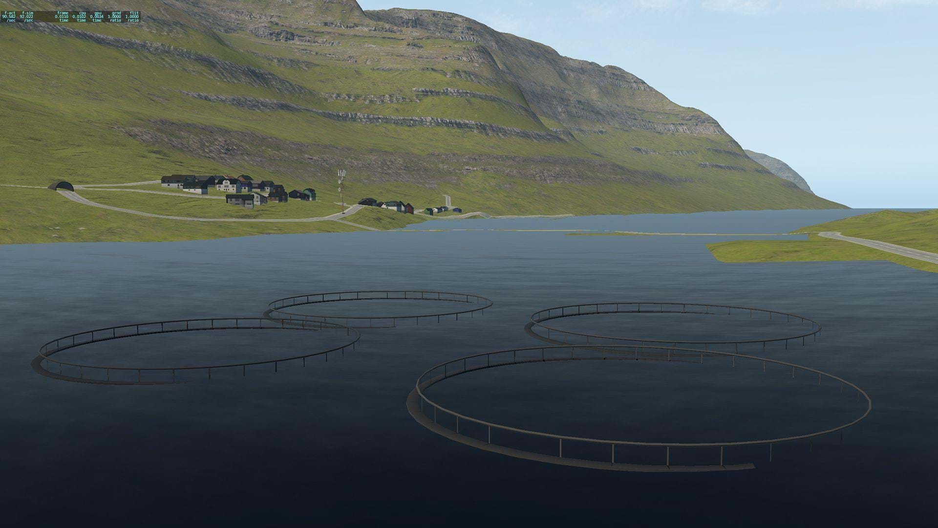
- Faroese-themed autogen, navigation obstacles and dynamic traffic on the islands
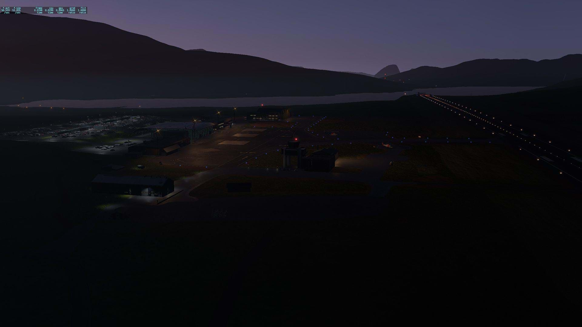
- Hundreds of custom objects with PBR materials, 3d vegetation, night lighting
A really good way to see the Faroe Islands is by following the real world routes of Atlantic Airways and their Helicopter Taxi service that flies between the islands.
Atlantic Airways use the AW139 and we now have the updated v4.0 available from X-Rotors (XP11.30 only) if your want to get even deeper immersions.
Installation
Installation couldn’t be simpler as you extract the zip file and copy the three folders to your “Custom Scenery” folder. Nothing more to say really.
Mesh/3D
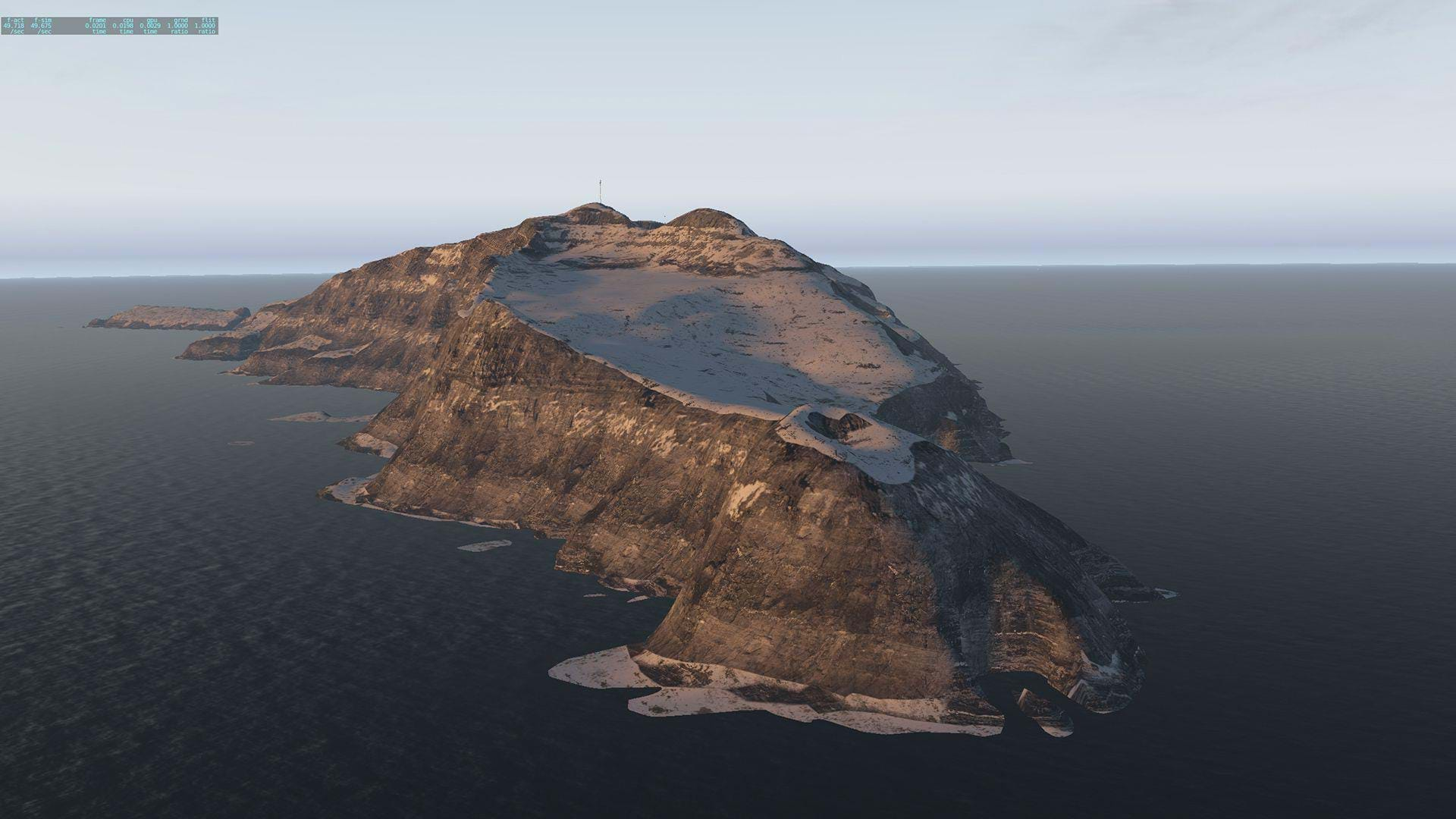
Maps2XPlane are known for their incredibly detailed terrain meshes and have contributed their work to many other scenery packages, not least of which is the stellar Krabi Outback series by Stefan Schroen. And so it comes as little surprise that the terrain mesh here is spectacular as well.
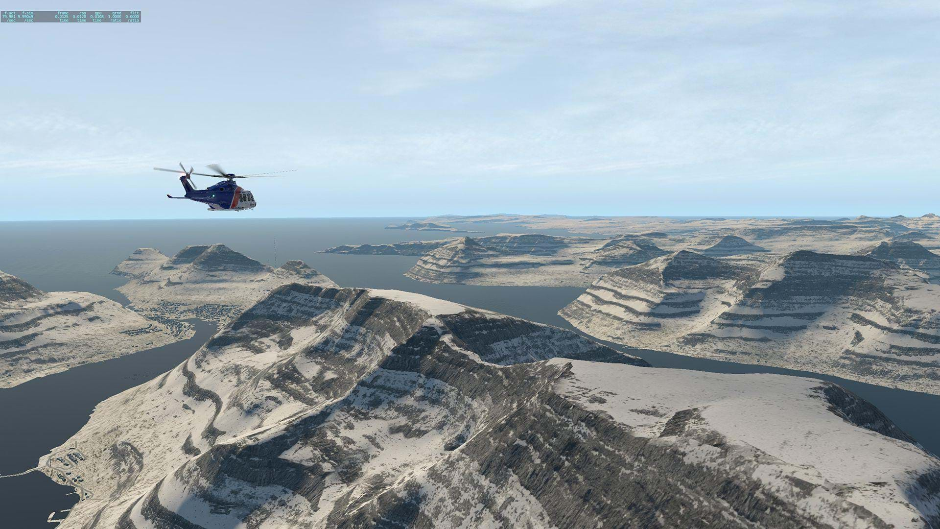
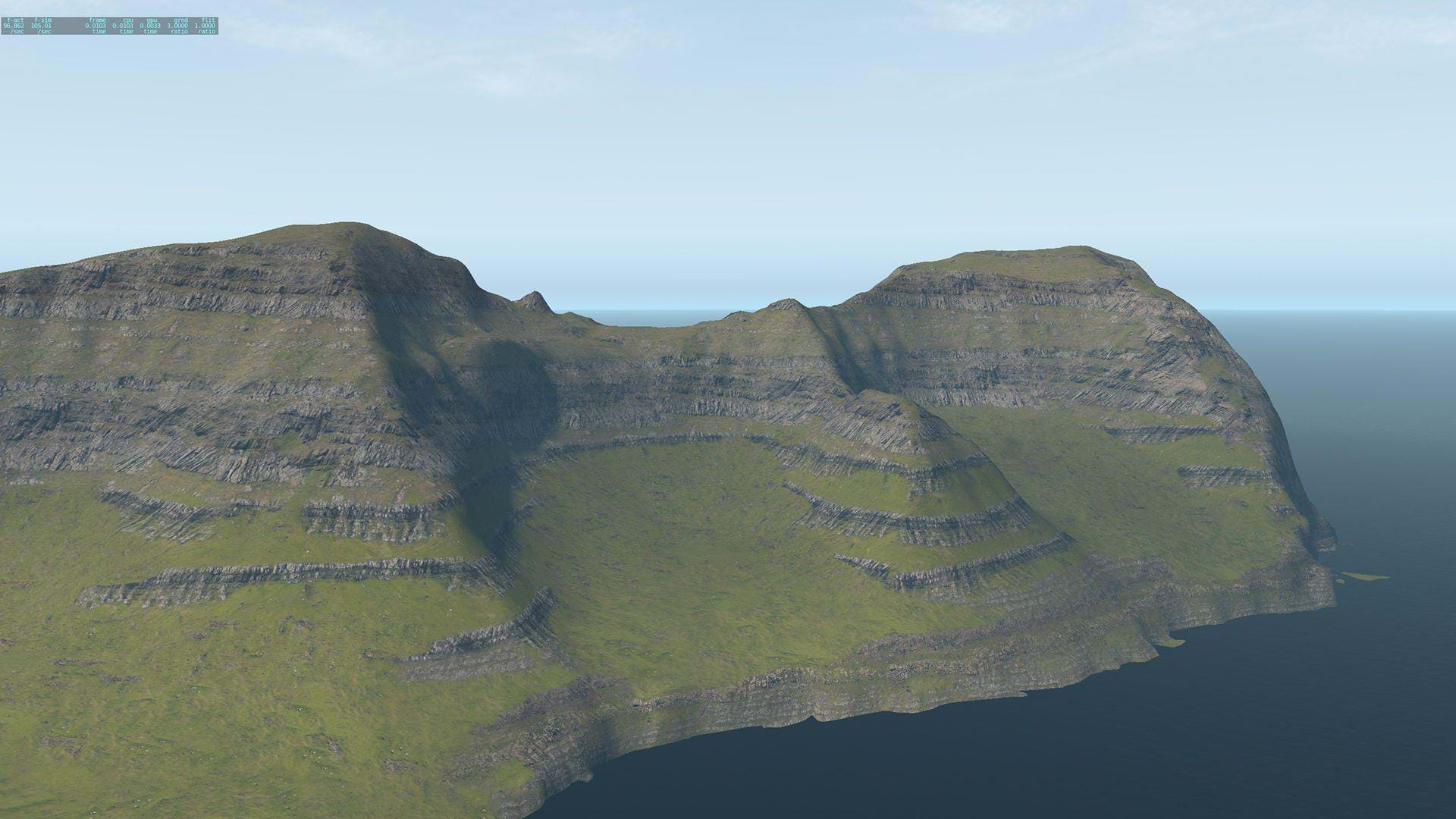
As I understand it, the incredible terrain of the Faroe Islands is one of main things that attracted Maps2XPlane to developing the scenery. Each island rises from the Ocean with many peaks, cliffs and lakes to explore. Combined with the fantastic ground textures (which I’ll talk about shortly) this contributes to an incredible realization of this area within X-Plane and I have been able to find many areas around the Faroes that mirror real world photography from many travel blogs.
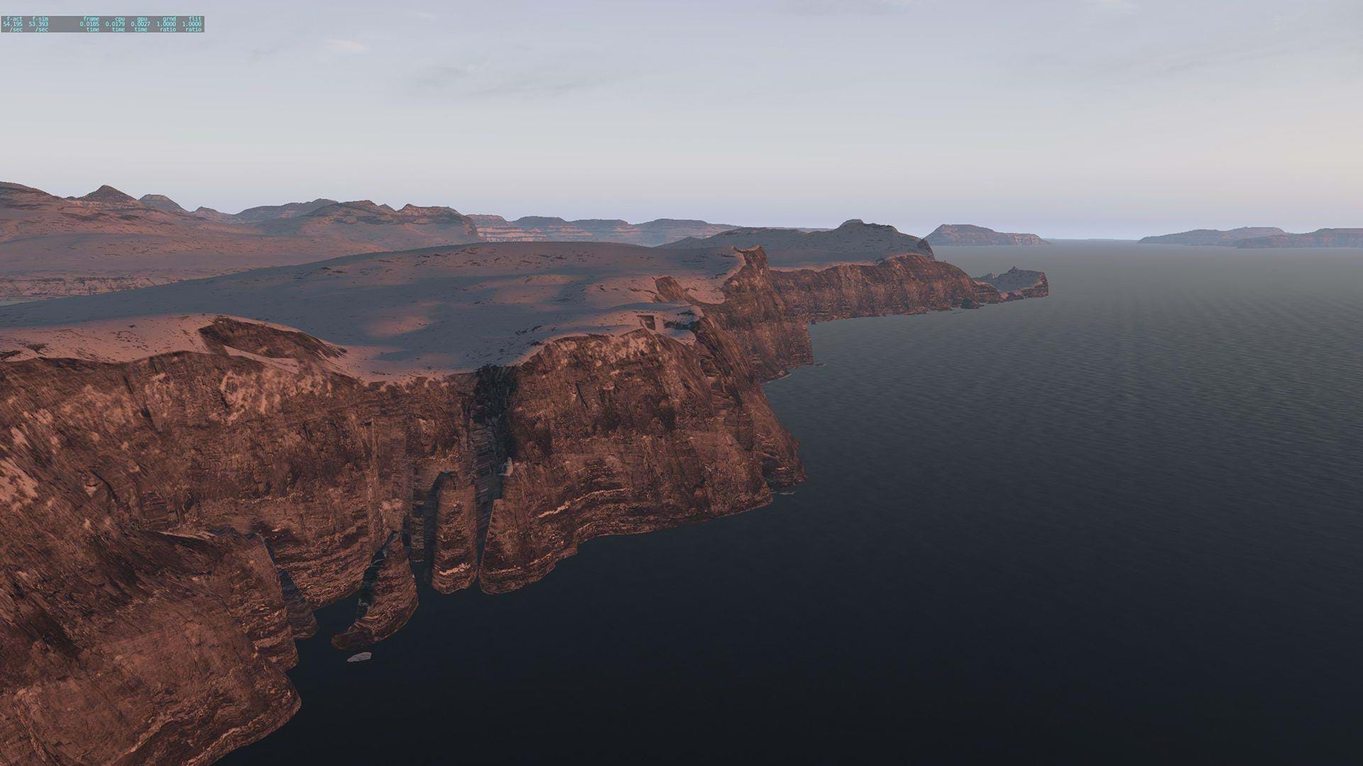
The developer has spent a lot of time refining their own custom toolkit for creating terrain meshes for XP based on real world data and that time has certainly paid off here. As you fly around the corner of one island heading for another, you’re greeted by more amazing scenery. Each flight I am finding something that I have not seen before, and that is certainly something you want from a scenery like this.
Textures
There are very few sceneries out there that include seasonal textures, but this is something else that Maps2XPlane have spent a lot of time and effort on.
In X-Plane we certainly have a love affair with our Ortho scenery thanks to the incredible Ortho4XP software. However, one shortcoming of Ortho is that you are stuck in whatever season the photos where taken. Which can be fine for some places in the world (like my own Australia) where you don’t get a lot of seasonal variation, however some places go through some dramatic changes and it’s something that the default XP Scenery doesn’t even handle, which FSX & P3D have always done. Well, no more, at least for the Faroe Islands!
I HIGHLY recommend starting a flight in summertime at any of the locations around the Faroes, and then change the date to another season and “Reload Scenery”. Lush green changes to burnt orange, to snowy white and then green starts to break through the white snow to again assert itself. This was one of the first things I did after installing the scenery. These constantly changing seasonal textures bring new life to the area every time you fly.
Maps2XPlane really have broken the mold here and I really hope that we see more like this. The quality of the textures is fantastic too, I could not fault them as I flew MEDEVAC or Transport flights between the islands.
Buildings
As mentioned in the intro, we have a full set of Custom Regional Autogen for the Faroe Islands which adds again to the immersion and beauty of this scenery package.
The main airport of Vágar is also well modelled with great attention paid to the buildings and structures around the airport and great use of XPs HDR lighting and PBR textures.
Frame rate impact
Everything in Faroes has been well optimised and so you should not experience any FPS drops at all if any. The only thing that did affect my FPS was the weather, which is one of the challenges flying in the Faroes brings, especially at this time of year (winter in the Northern Hemisphere), but weather always affects X-Plane FPS so that is no fault of the Faroes at all.
Speaking of weather, if you like to (as I do) fly with real world weather, then you may need to adjust that weather slightly after loading as the winds can be quite fierce in the Winter. Loading onto Vágar the other night I was greeted by 25Kts gusting 40Kts. I chickened out and edited the weather so that it was 10-15Kns less, but that’s just me.